iMapInvasives Beginner's Training
- 13 Nov 2020 At: 02:30:PM - 03:30:PM
- Online Webinar Hosted by the Western NY PRISM
- Register Now
iMapInvasives Beginner's Training
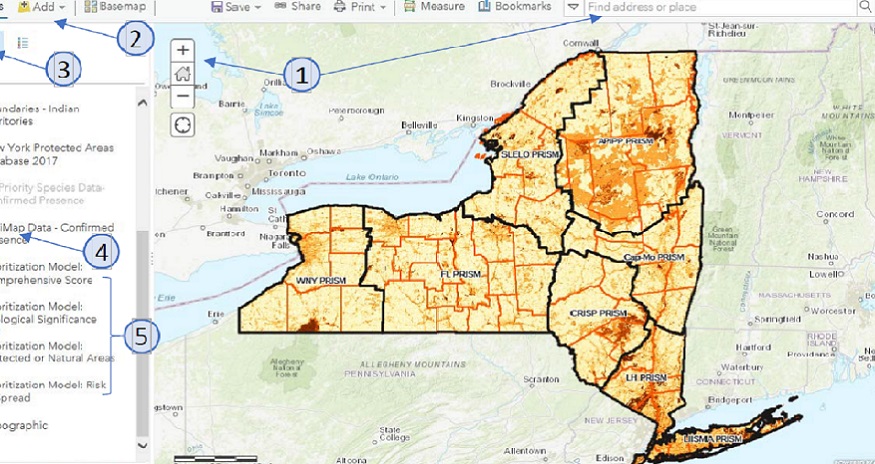
iMapInvasives is an on-line, collaborative GIS-based invasive species database and mapping tool used in several jurisdictions across North America. In New York State, iMapInvasives is the official state invasive species database used for: Reporting invasive species, Recording treatment efforts and tracking success, Early detection email alerts, Mapping invasive species distributions, Data analysis in the web interface and GIS, Creating data summaries and reports. Please register in advance.